
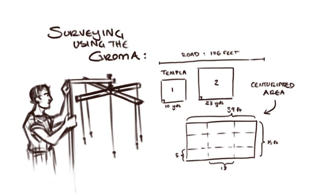
This week, we constructed a set of surveying tools and proceed to use them in measuring and surveying various areas around campus. The groma, a set of weights suspended from an X-shaped set of bars, was used to make straight lines and right angles, a very useful thing in charting roads, foundations, and other such constructions.
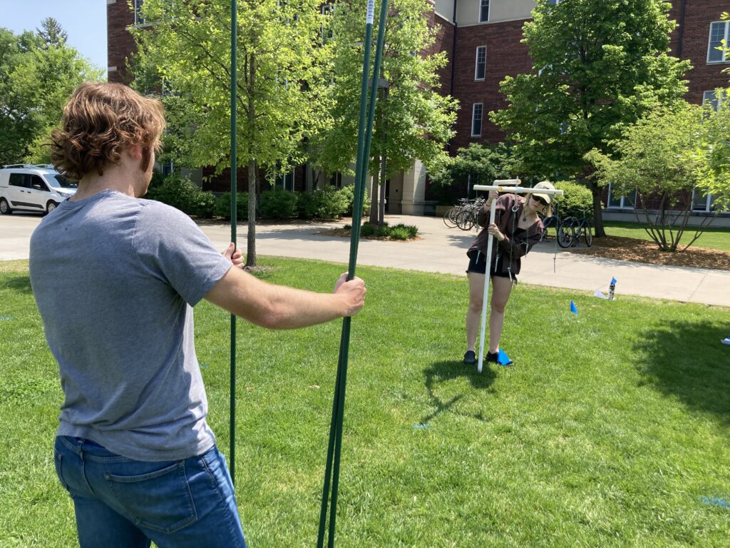

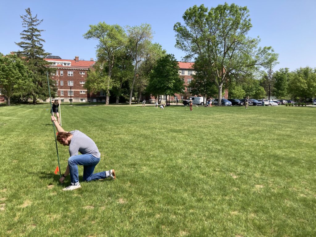
The devices, constructed primarily from PVC pipes, were first used to lay out a straight road of as great a length as possible. By planting the groma in the ground and aligning three of the suspended weights with individual upright poles, the line of the road could be established. Each pole was eventually replaced with a marking flag, so that the road remained visible while we proceeded onwards using the poles. Since a physical connection between each point in the line is not needed, as it would be if we were perhaps laying out our road using string instead, any obstacle could be avoided by simply placing the groma and poles on opposite sides of it, or, alternately, by moving around it in right-angled increments so as to reconnect with the original path of the road. After about 45 minutes of work, we had charted a road of about 176 feet and 2 inches across the field, although our measurements may have proven to be slightly off due to issues using the measurement wheel to calculate its length. While this was not a particularly long road, our focus on using precision in our more closely-set flag placement proved to be a useful preparation strategy for our later work with centuriation.
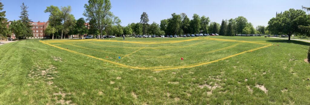
Next, using the groma to create straight lines and perfect right angles, we laid out plans for two templa of varying sizes, using the measuring wheel to calculate the lengths of the sides of our squares. Moving from established corner to established corner, we plotted two squares, one with sides of approximately 10 yards, and the other with sides of approximately 23 yards. Since maintaining a straight line over a greater distance was not required to lay out the templum square, this was quicker work than plotting the road.
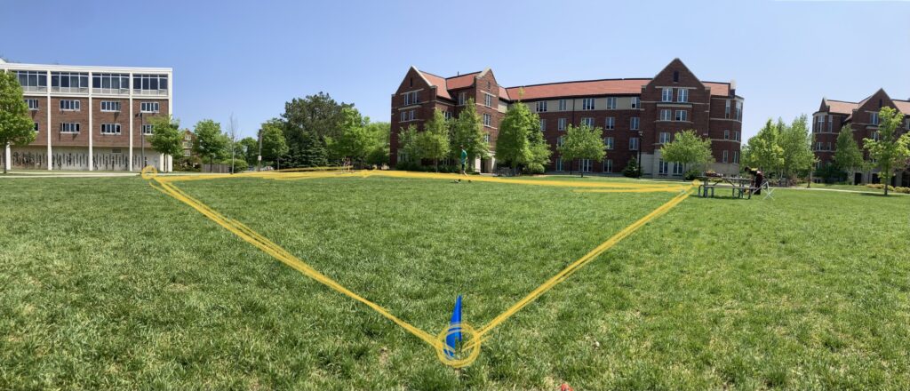
The final task was to centuriate a larger area – to chart out a larger rectangle, and divide it into equal sections, as if portioning out land in a Roman colony. Techniques learned both from our experiences with the roads and the templa were useful here, as both long, straight lines and well-organized rectangles were necessary. Working in larger surveying groups, we used multiple sets of tools to establish a large rectangle of approximately 15 feet by 39 feet. Once the larger rectangle had been laid out, it was divided into nine sections, each approximately 5 feet by 13 feet. This relied on the accuracy of our previous measurements, which caused some difficulty, as, even with the use of the groma, they were not as precise as we had initially intended. However, in the end, we managed to centuriate our plot of land with mild success.
0 thoughts on “DATA REPORT WEEK 9: Group D”